Lorena

Post Reply
User avatar
Tropical Inspector
Site Admin
Site Admin
Posts: 3790
Joined: Tue Feb 20, 2007 2:28 pm
Antispam: no
Location: Under a palm tree
Contact:

Lorena

Post by Tropical Inspector »

Tuesday Late Afternoon Update

Tropical Storm watches posted for parts of the Baja
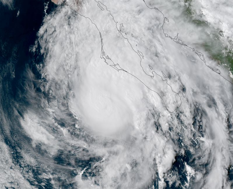
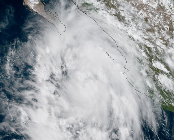
Lorena is organizing with a large area of showers and storms south of Cabo San Lucas and generally west of the western Mexican coast. Some showers have moved inland.

High surf and tropical storm winds may effect the southern Baja along with heavy downpours and flash flooding as Lorena approaches during the next few days.

The Weather Situation
SUMMARY OF 200 PM MST...2100 UTC...INFORMATION
----------------------------------------------
LOCATION...19.4N 109.0W
ABOUT 310 MI...495 KM W OF MANZANILLO MEXICO
ABOUT 250 MI...400 KM SSE OF CABO SAN LUCAS MEXICO
MAXIMUM SUSTAINED WINDS...50 MPH...85 KM/H
PRESENT MOVEMENT...NW OR 310 DEGREES AT 15 MPH...24 KM/H
MINIMUM CENTRAL PRESSURE...1002 MB...29.59 INCHES

Tropicast: Visible RAMMB/CIRA slider GOES 18
Image

Tropical Weather Forecast:
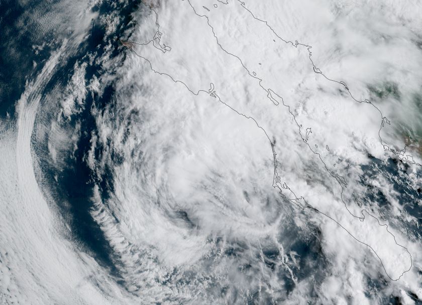
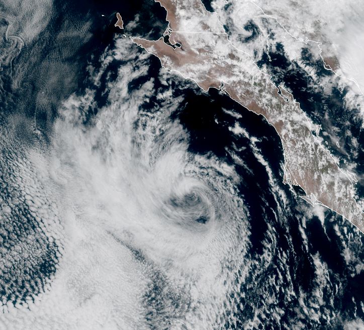
Lorena is expected to strengthen to hurricane strength by tomorrow. It will move NNW for a few days then turn to the northeast into the north part of the southern Baja north of Cabo San Lazaro on Friday. Weakening will likely occur before landfall as Lorena encounters colder water temperatures.
Rich Johnson
LinkedIn: https://www.linkedin.com/in/richjohnsonmeteorologist/
AMS Certified Broadcast Meteorologist (CBM) - Hurricane Expert
User avatar
Tropical Inspector
Site Admin
Site Admin
Posts: 3790
Joined: Tue Feb 20, 2007 2:28 pm
Antispam: no
Location: Under a palm tree
Contact:

Re: Lorena

Post by Tropical Inspector »

Wednesday Late Afternoon Update

Tropical Storm advisories continue for parts of the western Baja
Lorena is near minimal hurricane strength as reports from a reconnaissance aircraft report the most recent data. Tropical storm wind gusts could be seen over the advisory locations over the Baja. High surf will also be experienced on the western Baja coast especially near and south of landfall. Heavy rainfall will cause flash flooding with heavy rain into northwestern Mexico and southern Arizona and New Mexico.


The Weather Situation
SUMMARY OF 200 PM MST...2100 UTC...INFORMATION
----------------------------------------------
LOCATION...22.8N 112.4W
ABOUT 160 MI...255 KM W OF CABO SAN LUCAS MEXICO
ABOUT 140 MI...220 KM S OF CABO SAN LAZARO MEXICO
MAXIMUM SUSTAINED WINDS...80 MPH...130 KM/H
PRESENT MOVEMENT...NW OR 315 DEGREES AT 15 MPH...24 KM/H
MINIMUM CENTRAL PRESSURE...985 MB...29.09 INCHES

Tropicast: Visible RAMMB/CIRA slider GOES 18
Image

Tropical Weather Forecast:
Lorena will possibly strengthen a little into Thursday then weaken over cooler water Friday before landfall north of Cabo San Lazaro.
Rich Johnson
LinkedIn: https://www.linkedin.com/in/richjohnsonmeteorologist/
AMS Certified Broadcast Meteorologist (CBM) - Hurricane Expert
User avatar
Tropical Inspector
Site Admin
Site Admin
Posts: 3790
Joined: Tue Feb 20, 2007 2:28 pm
Antispam: no
Location: Under a palm tree
Contact:

Re: Lorena

Post by Tropical Inspector »

Thursday Afternoon Update

Lorena weakening
Satellite imagery shows that Lorena is rapidly weakening and that the 70 mph sustained winds is likely a very robust estimate now. Colder water is robbing the energy from Lorena and the low level circulation is getting exposed. Heavy rainfall with flash flooding is the main concern on the Baja and northwestern Mexico.

The Weather Situation
SUMMARY OF 800 AM MST...1500 UTC...INFORMATION
----------------------------------------------
LOCATION...24.2N 114.2W
ABOUT 125 MI...205 KM WSW OF CABO SAN LAZARO MEXICO
MAXIMUM SUSTAINED WINDS...70 MPH...110 KM/H
PRESENT MOVEMENT...NW OR 310 DEGREES AT 8 MPH...13 KM/H
MINIMUM CENTRAL PRESSURE...991 MB...29.27 INCHES

Tropicast: Visible RAMMB/CIRA slider GOES 18
Image

Tropical Weather Forecast:
Lorena will now weaken west of the Baja by Friday. The main threat will be heavy rainfall and flash flooding.
Rich Johnson
LinkedIn: https://www.linkedin.com/in/richjohnsonmeteorologist/
AMS Certified Broadcast Meteorologist (CBM) - Hurricane Expert
User avatar
Tropical Inspector
Site Admin
Site Admin
Posts: 3790
Joined: Tue Feb 20, 2007 2:28 pm
Antispam: no
Location: Under a palm tree
Contact:

Re: Lorena

Post by Tropical Inspector »

Friday Afternoon Update

Remnants of Lorena
Satellite imagery shows the low level swirl of what was Lorena remaining west of the central Baja.

Tropicast: Visible RAMMB/CIRA slider GOES 18
Image
Rich Johnson
LinkedIn: https://www.linkedin.com/in/richjohnsonmeteorologist/
AMS Certified Broadcast Meteorologist (CBM) - Hurricane Expert
Post Reply

Return to “2025 Eastern / Central Pacific Hurricane Updates”

Who is online

Users browsing this forum: No registered users and 14 guests