Juliette
Posted: Tue Aug 26, 2025 1:05 pm
Tuesday Afternoon Update
Juliette stronger
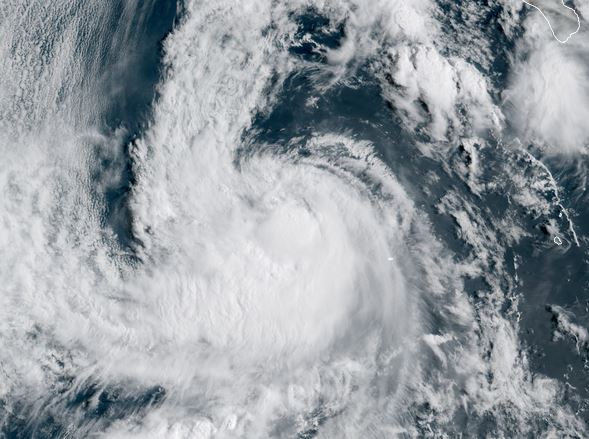
Satellite imagery shows convection deepening near the core. This will be temporary as forward motion takes Juliette over cooler water. Most of the showers and storms associated with Juliette are well west of the Baja with only a few lingering offshore.
The Weather Situation
SUMMARY OF 800 AM PDT...1500 UTC...INFORMATION
----------------------------------------------
LOCATION...19.1N 116.5W
ABOUT 360 MI...580 KM W OF SOCORRO ISLAND
ABOUT 500 MI...805 KM WSW OF THE SOUTHERN TIP OF BAJA CALIFORNIA
MAXIMUM SUSTAINED WINDS...70 MPH...110 KM/H
PRESENT MOVEMENT...NW OR 320 DEGREES AT 10 MPH...17 KM/H
MINIMUM CENTRAL PRESSURE...994 MB...29.36 INCHES
Tropicast: Visible RAMMB/CIRA slider Afternoon
Tropical Weather Forecast:
Juliette will continue NNW over cooler water well west of the Baja weakening over the next few days.
NHC Advisory
https://www.nhc.noaa.gov/text/refresh/M ... 432.shtml?
NHC Track
https://www.nhc.noaa.gov/refresh/graphi ... e#contents
Juliette stronger
Satellite imagery shows convection deepening near the core. This will be temporary as forward motion takes Juliette over cooler water. Most of the showers and storms associated with Juliette are well west of the Baja with only a few lingering offshore.
The Weather Situation
SUMMARY OF 800 AM PDT...1500 UTC...INFORMATION
----------------------------------------------
LOCATION...19.1N 116.5W
ABOUT 360 MI...580 KM W OF SOCORRO ISLAND
ABOUT 500 MI...805 KM WSW OF THE SOUTHERN TIP OF BAJA CALIFORNIA
MAXIMUM SUSTAINED WINDS...70 MPH...110 KM/H
PRESENT MOVEMENT...NW OR 320 DEGREES AT 10 MPH...17 KM/H
MINIMUM CENTRAL PRESSURE...994 MB...29.36 INCHES
Tropicast: Visible RAMMB/CIRA slider Afternoon
Tropical Weather Forecast:
Juliette will continue NNW over cooler water well west of the Baja weakening over the next few days.
NHC Advisory
https://www.nhc.noaa.gov/text/refresh/M ... 432.shtml?
NHC Track
https://www.nhc.noaa.gov/refresh/graphi ... e#contents